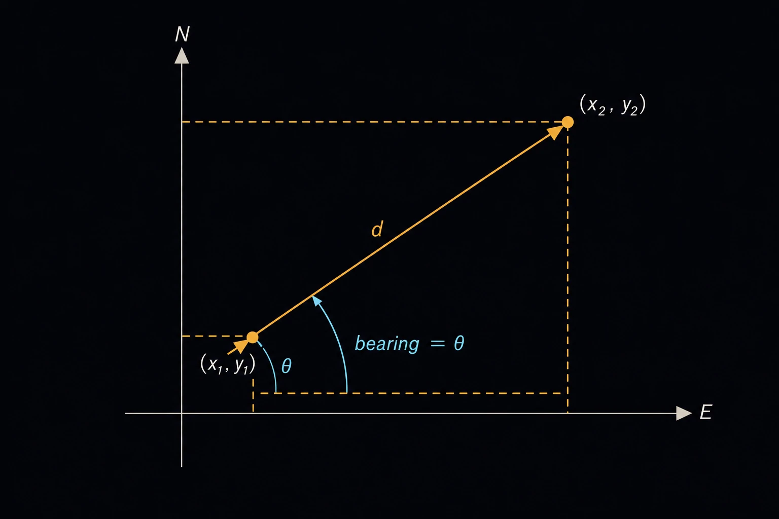
Coordinate Inverse (Distance & Bearing)
Finds the horizontal distance and direction from one surveyed point to another, given the northing and easting of each. Surveyors call this an inverse. It is used to stake out points from control, to check a traverse against record coordinates, and to write the distance and bearing of a property line on a plat [1].
How it is calculated
The coordinate differences are the line’s latitude and departure:
ΔN = N2 − N1 ΔE = E2 − E1
D = √(ΔN2 + ΔE2) Az = atan2(ΔE, ΔN)
where N is the northing and E the easting of each point, D the horizontal distance and Az the azimuth: the clockwise angle from north, 0 to 360°. The two-argument arctangent puts the line in the right quadrant from the signs of ΔE and ΔN. The quadrant bearing gives the same direction as an angle of 0 to 90° east or west of north or south. For example, an azimuth of 132.18° is S 47.82° E, because 180 − 132.18 = 47.82. The page writes the bearing in degrees, minutes and seconds to 0.1″.
Limits and common mistakes
- Northing comes first. Swapping N and E mirrors the line about the 45° diagonal and gives a wrong direction with the right distance.
- The direction runs from Point 1 to Point 2. Swapping the points turns it by 180°.
- The distance is on the coordinate grid. On a state plane or UTM grid, multiply by the combined scale factor to get the ground distance.
- The azimuth is from grid north. It differs from true north by the convergence angle and from magnetic north by the declination.
- Any unit works for N and E, as long as both points use the same one. The distance comes out in that unit.
Worked example
A crew must stake a new property corner from control point CP-1. CP-1 is at N 5000.000, E 3000.000 and the corner at N 4612.345, E 3427.810 (meters). What distance and bearing should they set out?
- Enter Point 1 Northing 5000 and Point 1 Easting 3000.
- Enter Point 2 Northing 4612.345 and Point 2 Easting 3427.81.
- Press Solve. The Solution shows:
Latitude (ΔN): −387.655 m
Departure (ΔE): 427.81 m
Horizontal distance: 577.319 m
Azimuth from north: 132.181 deg
Quadrant bearing: S 47°49′8.7″ E
Check by hand. The line runs south (ΔN negative) and east (ΔE positive), so it lies in the SE quadrant. √(387.6552 + 427.812) = √333,297 = 577.32 m. The bearing angle is arctan(427.81 / 387.655) = 47.819°, and 0.819° × 60 = 49.14′, 0.14′ × 60 = 8.7″. The azimuth is 180 − 47.819 = 132.181°.